
Our third and final post revisit today is Brad Donald from B&W Rural in Moree:
While most of our users primarily use Satamap as a scouting, management and monitoring tool, you can export Landsat 8 data from Satamap to be used in farm mapping software such as Farmworks and SMS Advanced. The following example is thanks to Brad Donald at B&W Rural in Moree. You may have spotted him around the country flying the AgEagle UAV. Brad is an agronomist and has a passion for technology in farming.
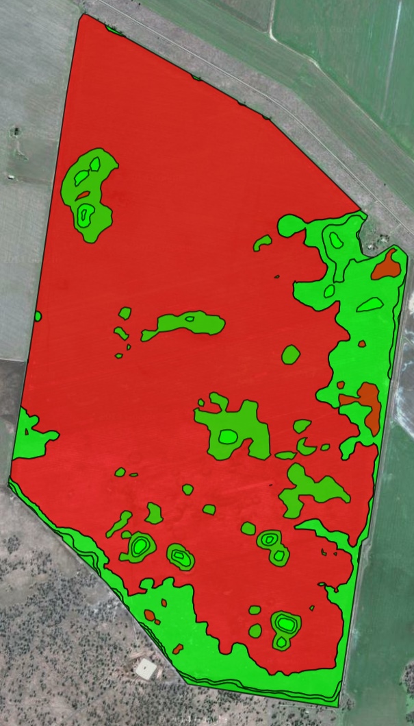
Weedseekers/WeedIts are great for spot spraying weeds that are already established – but this is reactive rather than proactive. Residual herbicides such as Imazapic (Flame) are commonly used to aid in the control of summer grasses such as barnyard grass. Brad thought that if he could get an image from last summer that represents areas of the paddock that have a high biomass it would be a sensible assumption of a high seed bank. He would apply a higher herbicide rate in these areas than the rest of the paddock for the 2015/16 summer.
Brad exported an image from 2013 as a POINT shapefile. With this he was easily able to import into SMS Advanced to generated a variable rate map. The ability to import into SMS Advanced and Trimble’s Farmworks as a POINT shapefile means these software packages deal with the data similar to yield data which makes for easy processing.
Brad’s tip for this project is that the map was written to simply change water volume applied, which was done automatically by the rate controller. Application rate changes are limited to staying within certain pressure ranges for droplet size management.

Satamap image of fallow captured in 2013 SW of Moree. Yellow/green areas are higher biomass
Variable rate map constructed from Satamap data for residual herbicide application.